urbanism – landscape – ideas – theory – whimsy

Analyzing Urban Form by Block Shape and Size

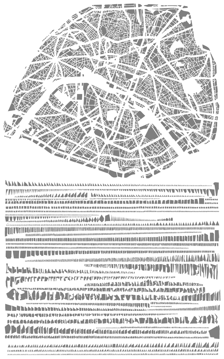
The block pattern of Paris in map form and arranged by shape and size

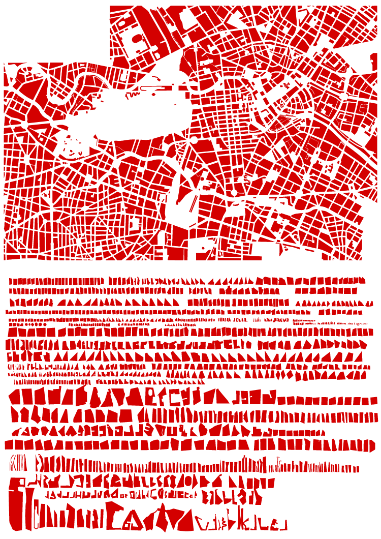
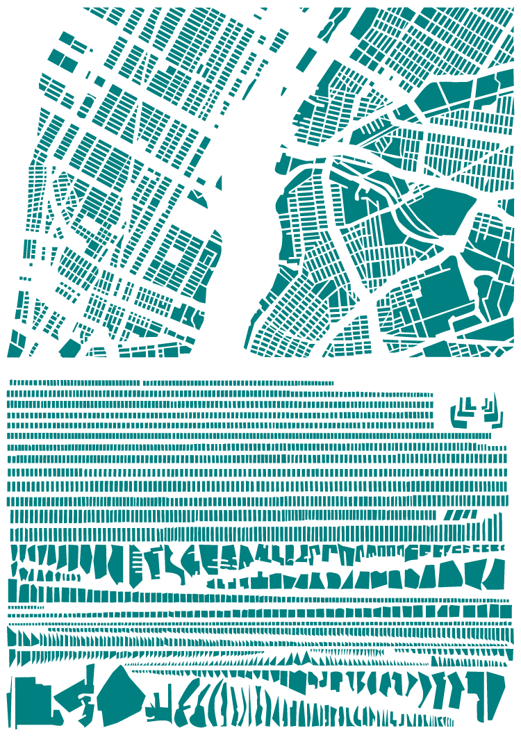
French artist Armelle Caron has created a series called “tout bien rangé” in which the block patterns of various cities have been disassembled, sorted by shape and size and rearranged as a new graphic representation of the city. While the result of the taxonomicalish classification and reorganization is not particularly useful from an urban design perspective (the city maps don’t seem to be at the same scale, for one), it’s certainly an interesting way to look at the city, and to think about blocks, block size and block shape, which are such an integral and enduring element of our cities’ urban forms. See all of the pieces on the artist’s site. (via Strange Maps)

For something similar see The Patterns of the Urban Fabric of Beijing’s Hutong.

The block pattern of New York (part of Manhattan and part of Brooklyn) in map form and arranged by shape and size


The block pattern of central Berlin in map form and arranged by shape and size

Toronto From the Perspective of Flickr and Twitter

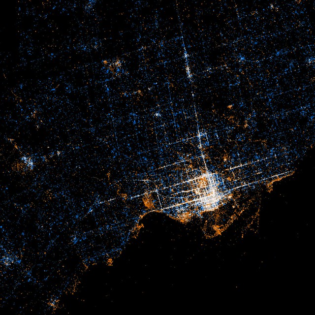
Toronto from the perspective of Flickr and Twitter: Red dots are locations of Flickr pictures. Blue dots are locations of Twitter tweets. White dots are locations that have been posted to both (image: Eric Fischer at Flickr.com). Move over with mouse to see Google Map overlay to locate yourself.

An interesting (and beautiful) set of maps have been made by Flickr user Eric Fischer showing maps of the locations of Flickr photos and Twitter activity in major urban centres around the world (see the full set called “See something or say something” to compare to other cities). What’s interesting is how clearly the downtown street fabric of Toronto (and other cities) is revealed by people’s photos and tweets. While it might seem obvious that the streets (being our main public realm) are the places where the most concentrated activity of this kind takes place, it still suggests things about how people use the city and of what and where they choose to take photos. Outside the core, the main photo concentrations appear to be the waterfront and major parks, with a few splotches at major urban nodes which suggests a large preference for taking photos of the natural environment. Meanwhile the Twitter activity is much more evenly spread across the city, although still concentrated enough around the major streets of the city to give a suggestion of the street network. The clarity with which Yonge St, Bloor/Danforth and Queen St stand out shows just how much activity in general in Toronto is concentrated around these three streets that most of us know are the main spines of the city. If only Queen St had a subway line recognizing this to match the other two!

Image 01

Beautiful Urban Moments – Part X

403_1090296

Beautiful flower murals on telephone utility boxes along the north side of Yorkville Ave, east of Hazelton Ave in front of Teatro Verde, Yorkville, Toronto

This is a great example of the creative potential of a simple solution to vastly improve the aesthetics of one of the typically ugly pieces of urban infrastructure, the telephone utility box. While land-line telephones may be on the way out, there’s still plenty of urban infrastructure that could similarly benefit from some creative attention. The mural is by Bruni Nielsen and is in Yorkville, Toronto along the north side of Yorkville Ave, east of Hazelton Ave in front of Teatro Verde.

Tahrir Square, Cairo – From Traffic Circle to Civic Square

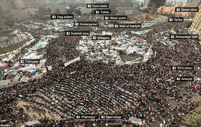
Annotated photo from BBC (over Reuters photo) of Tahrir Square, Cairo at the height of the protests (click through to BBC to read the annotations

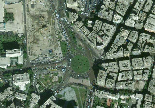
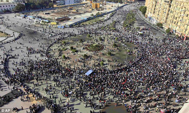
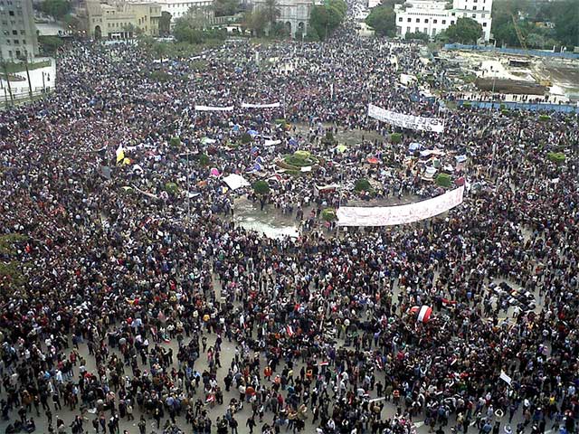
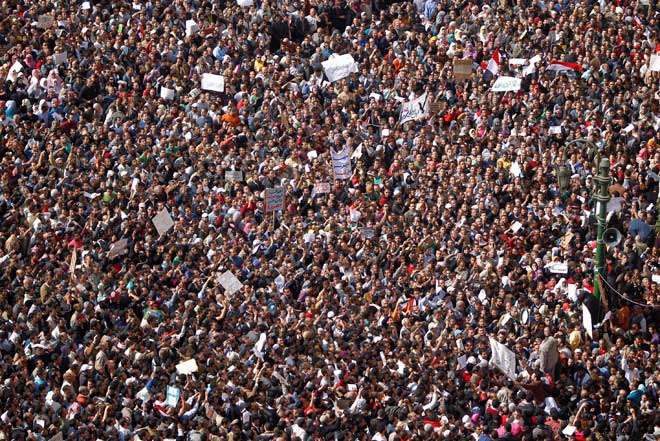
Tahrir Square in central Cairo became the nucleus for unprecedented protests against the government in Egypt in February. While the name Tahrir means Liberation (referring to the Egyptian revolution against British rule in 1919, but subsequently co-opted to also refer to the 1952 military coup that removed the Egyptian monarchy and established the modern Republic), the space itself normally hardly serves as a great civic square, being for all intents and purposes a huge traffic circle.

Tahrir Square area from Google Maps

But it just goes to show that the utility of a civic square lies as much in its imagined symbolic role as in its intended programme and design – the key requirement is largely that the space is simply open. It doesn’t matter if it’s legally accessible, or if the law allows peaceful assembly. In times of crisis or great importance, people will gather in the place that captures the public imagination. After all, traffic is certainly no obstacle to a revolution.

Tahrir Square - Daily Mail (Associate Press) photo

Tahrir Square on Friday of Departure (Feb 4th) by Flickr user Mona Sosh

Crowds in Tarhrir Square (Photo: AP/Tara Todras-Whitehill)

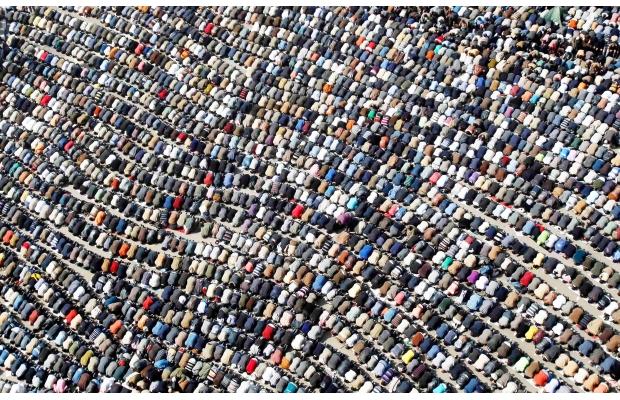
Friday prayers by the Tahrir Square demonstrators, photo by Amr Addullah Dalsh (Reuters via Calgary Herald)

Lujiazui and the “Pudong Miracle” – 20 Years of Transformation

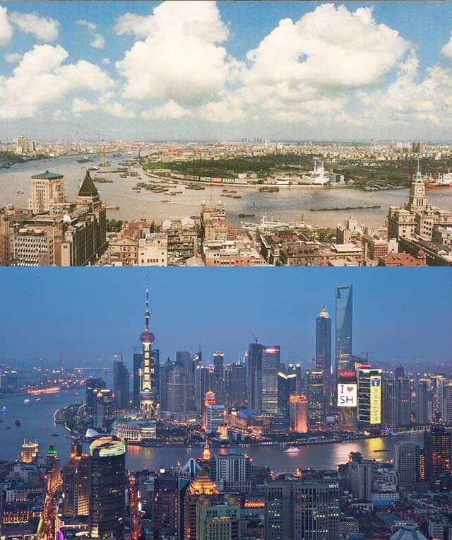
Lujiazui financial district in Pudong seen in 1990 and in 2010 from across the Huangpu River over the Bund in the historic International Settlement area of central Shanghai

The Pudong New Area (浦东新区) in Shanghai was first masterplanned in 1990, at a time when most of Pudong (浦东, named for being east (东) of the Huangpu River (浦), as opposed to Puxi (浦西) west (西) of the river) was factories, warehouses, villages and farmland with typical 1980’s Chinese residential development taking place. At that time Pudong had only 2 road tunnels under the Huangpu River connecting it to the rest of Shanghai and Shanghai’s first metro line had not even started construction. Shanghai’s metro line 2 linking Pudong to central Shanghai would not open until 1999, but by then Pudong was already well on it’s way to representing a model of the dream of highly planned and modern rapid development that China was reaching for.

The Lujiazui (陆家嘴) area in particular had already started to become an icon of the city as Shanghai’s new financial centre, its visibility and image guaranteed by its position directly opposite Shanghai’s historic Bund where the hoards of tourists who came to see Shanghai’s history could also see the city’s future in the forest of towers across the river.

Fast forward to 2010, and Pudong is connected to the rest of Shanghai by four huge bridges and five road tunnels, and serviced by 6 metro lines. The whole thing is a stunning representation of the development of Shanghai (and China) over the last 20 years, years that have changed Shanghai forever.

On the other hand, from an urban design perspective, Pudong can be seen as part of a much larger failure of suburban planning and design in China and around the world. Even in Lujiazui, surrounded by office towers, the enormous roads, distance between buildings and lack of pedestrian scale make a clear (and no doubt intentional) break with the historic city in Puxi, and there is a complete lack of character as a result of what can clearly be recognized as a suburban planning philosophy (with “Chinese characteristics”). This has even produced a cultural split between people who prefer Pudong and people who prefer Puxi, with, in some people’s minds, Puxi representing the past and a lesser quality of life, and Pudong representing the future and the modern lifestyle expected by upwardly mobile people in China these days.

The urban design success of Lujiazui is largely scenic – it is meant to be seen from across the river as a symbol of Shanghai’s rise onto the world stage, and act as a platform to look back at the old city from the heights of the city’s current success. Lujiazui’s intended function as Asia’s preeminent financial centre should have produced one of the great modern urban districts, but the result is still best experienced from across the river while walking along the Bund, Shanghai’s 150 year old international financial centre and one of the great streets of the world.
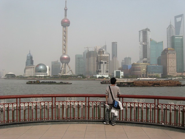
The view from the famous Bund along the Huangpu River, showing Lujiazui and its towers

Source: Before/After image via Reddit
The Patterns of the Urban Fabric of Beijing’s Hutong

370 of the 1500 patterns of the urban fabric of Beijing's hutong from Instant Hutong's Community Catalogue 2007

Part of Instant Hutong’s Community Catalogue 2007, a catalog of hutong block patterns laid out as a “series of 1500 communities of courtyard houses cut out and isolated from the map of downtown Beijing”.

Via Ministry of Type, image sourced from Instant Hutong’s portfolio on the Behance Network

Mina Tent City, Mecca

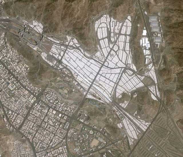
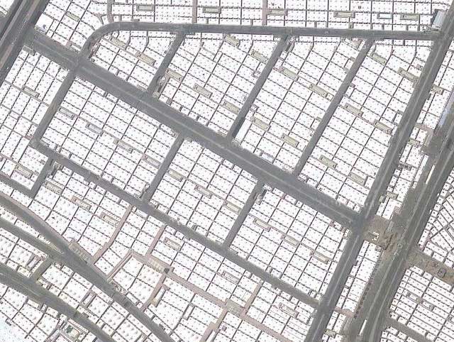
Google Maps satellite photo of Mina Tent City, Saudi Arabia - Mecca is to the left (west)

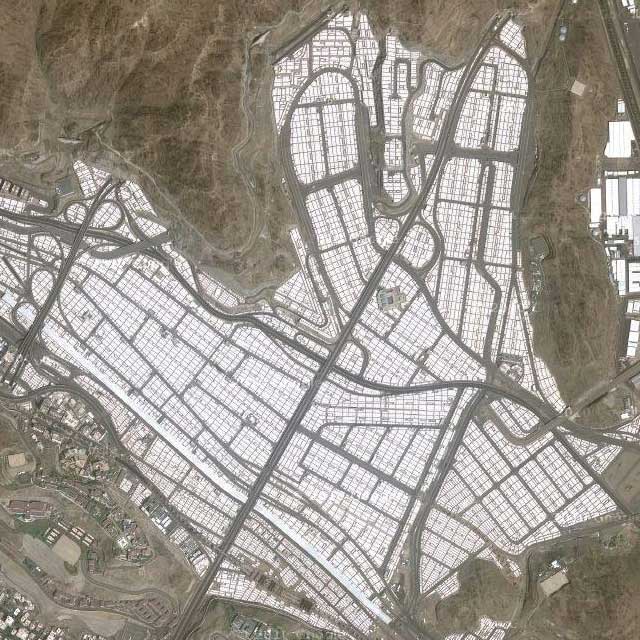
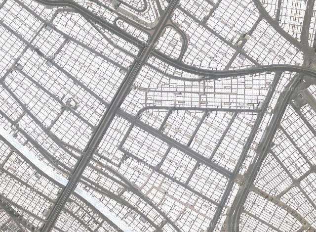
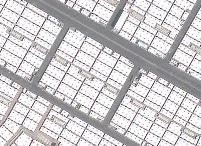
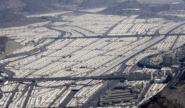
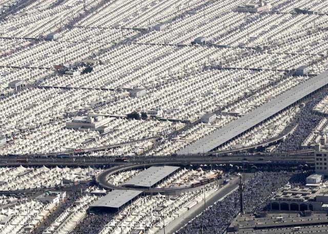
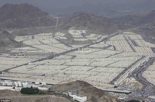
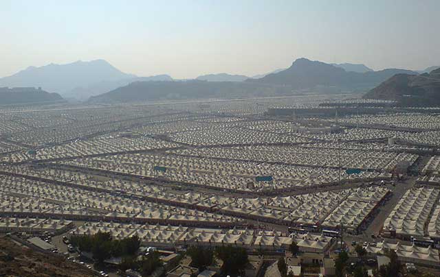
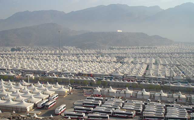
What does a temporary tent city for 3 million people look like? A recent visit to Expo 2010 in Shanghai clued me in to what is probably the largest ephemeral urban design in the world, the Mina Tent City in Saudi Arabia, erected each year to house Hajj pilgrims visiting Mecca during the last month of the lunar Islamic calendar. The tent city is stunningly portrayed in a pavilion in the Urban Best Practices Area of Expo 2010, with huge wall size aerial photos and birdseye views that do far more justice to the scale of the tent city than what I can show online. The tent city is erected in a valley next to the village of Mina, east of Mecca itself. It is an extremely regimented design with infrastructure such as toilets and water supply designated for a reasonable number of tents in each cell. The tents are standardized and have been designed to be well ventilated and prevent fires that used to be common in the more chaotic pilgrim tent cities of the past. The planning, design, atmosphere and overall purpose are perhaps the diametrical opposite of Black Rock City (the temporary city created for the Burning Man Festival each year) that I posted about in 2007, although the size, population, and crazy logistics of transportation at Mina Tent City and for the Hajj in general is orders of magnitude greater than anything the Black Rock City needs to handle.

Google Maps satellite photo of Mina Tent City, Saudi Arabia - detail level 2

Google Maps satellite photo of Mina Tent City, Saudi Arabia - detail level 3

Google Maps satellite photo of Mina Tent City, Saudi Arabia - detail level 4

Google Maps satellite photo of Mina Tent City, Saudi Arabia - detail level 5

Here are some birdseye views of what Mina Tent City looks like:

Image: Daily Mail

Image: Zawaj.com

Image: Reuters/Daily Mail

Image: Panoramio (Dr.M.Nazir Awan)

Image: Wikimedia Commons

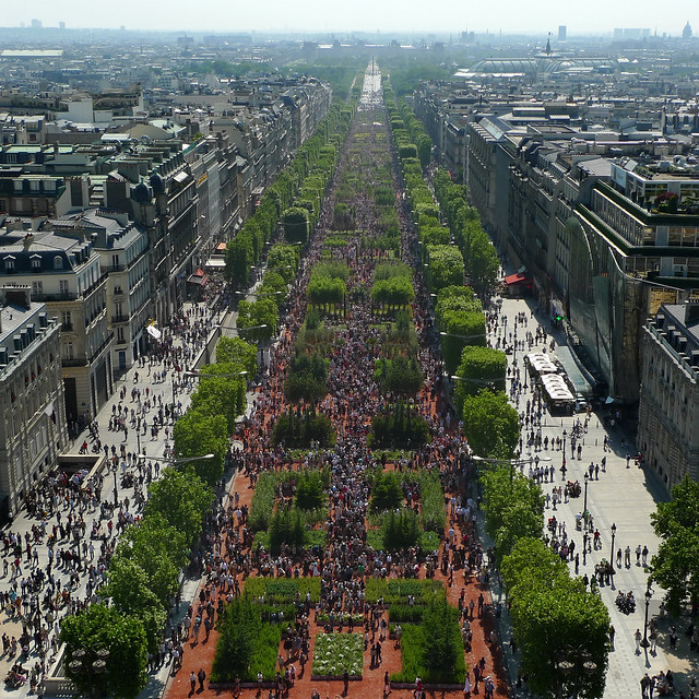
Champs-Élysées goes green, literally

Photo: Xavier Defaix for Nature Capitale (via Flickr)

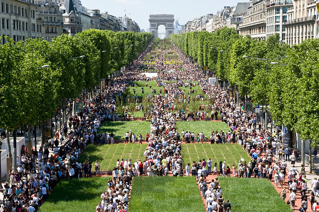
The Avenue des Champs-Élysées was recently temporarily turned into a green oasis for a weekend for Nature Capitale, a gigantic art installation by “street artist” Gad Weil (who also turned the Champs into a huge field of wheat 20 years ago) and the visual artist and landscape artist Laurence Medioni with the help of agricultural and forestry professionals which was created as part of a protest by young French farmers angry at their increasingly difficult economic situation beset by falling incomes. It is an attempt to reconnect Parisians with the countryside and includes 150,000 plants covering more than 3 hectares of the avenue, as well as sheep, pigs and cows held in pens.

This brings to mind the temporary turfing over of Trafalgar Square in London I posted about in 2007 but is so much bigger and way more impressive.

Photo: fabiengelle on Flickr

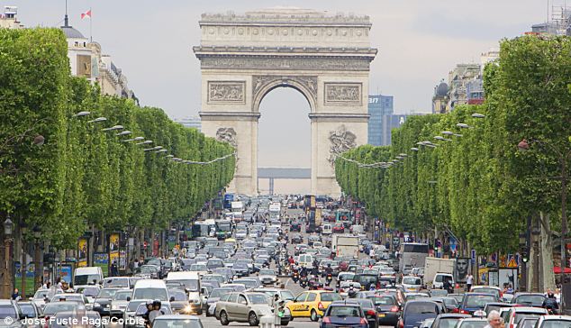
Compare this to a normal day on the Champs (below), and you have to wonder why it shouldn’t be a green oasis every day!

Photo: Champs-Elysees on a normal day (from Daily Mail)

Phnom Penh in 2004

DSCF2202-scan

Dilapidated streets and buildings in Phnom Penh, January 2004

These photos from scans of film prints of Phnom Penh in Cambodia from January 2004 show the unique dilapidated atmosphere of the city at the time. My digital camera had broken while at the Angkor temples but luckily I had my mini film camera as backup (also see post on a Thai market square). I recently read that significant new development is starting to happen in Phnom Penh (or at least be proposed), so I imagine that the city will start changing at a more rapid pace, but one hopes that before that happens they at least have gotten a handle on basic maintenance of the public infrastructure and cleaned the detritus from the less major streets with some frequency… perhaps the lingering smell of sewage is no longer pervasive. Despite all that, Phnom Penh has this amazing character that hopefully will shine through whatever changes the city is going through.

Browse more photos of Phnom Penh here at bricoleurbanism.org

…or at Flickr on my Phnom Penh Flickr Set

DSCF2200-scan

Dilapidated streets and buildings in Phnom Penh, January 2004

DSCF2203-scan

Dilapidated streets and buildings in Phnom Penh, January 2004

DSCF2205-scan

Inside Kandal market in Phnom Penh, January 2004

DSCF2224-scan

Sisowath Quay along the Tonle Sap River, including FCC Building (Foreign Correspondents Club), Phnom Penh, January 2004

DSCF2210-scan

Phsar Thom Thmei (aka Central Market), opened in 1937, modernist concrete Art Deco style, Phnom Penh, January 2004

DSCF2212-scan

Small lane next to Boeng Kak Lake, Phnom Penh, January 2004

DSCF2230-scan

A building off Blvd Samdach that looks something like a vertical slum, Phnom Penh, January 2004

Day in the Life of a Market Square in Thailand

DSCF2246-scan

I was scrummaging around my hard drive and came across some scans I had done of film prints of Cambodia and Thailand from January 2004 but hadn’t cleaned up and catalogued. My digital camera had broken while at the Angkor temples in Cambodia but luckily I had my mini film camera as backup. While relaxing for a couple of days in the small Thai town of Trat near the Cambodian border (to recover from the intensity of Cambodia and the gruelling road trips in and out), I managed to get some shots of the amazing transformations of the town’s market square through the course of a day.

In the morning there’s a fairly intense wet market (for fruit, vegetables and meat), with temporary stalls with all kinds of umbrellas and canopies for protection from sun and rain. Later in the day, the wet market closes and disappears and the market square gets cleaned up and sits there empty. Then in late afternoon, the night market starts to set up with food stalls with patio furniture seating, some fruits, vegetables and dry goods. The night market runs right through the evening with a great variety of dishes available from a multitude of stalls and a fantastic outdoor eating and drinking atmosphere.

While to a casual observer it seems a bit chaotic, it’s clearly highly organized and well managed – there are even painted lines on the square surface organizing the setup. What’s most striking is how this compares to the ridiculous way some Western public squares such as Dundas Square or Nathan Phillips Square are managed, with corporate events and advertising, overbearing security, and any lively activities like what takes place in Trat every day confined to strict and infrequently programmed “events”.

DSCF2244-scan

The morning wet market of temporary stalls, Trat, Thailand

DSCF2247-scan

The morning wet market of temporary stalls viewed from above, Trat, Thailand

DSCF2252-scan

After the wet market closes, the empty market square, Trat, Thailand

DSCF2269-scan

Setting up the night market of food stalls in late afternoon, Trat, Thailand

DSCF2242-scan

Night market of food stalls in early evening, Trat, Thailand

DSCF2270-scan

Night market of food stalls after dark, Trat, Thailand