urbanism – landscape – ideas – theory – whimsy

Beautiful Urban Moments – Part I

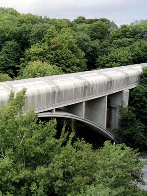
This might not seem like an urban moment – but since it’s but a few minutes walk from Bloor and Yonge in Toronto, it gives you an idea of the wealth that the ravines give this city. This is the Bloor-Danforth subway line as it crosses the Rosedale Ravine viewed from Bloor Street East. The Rosedale Valley Road can just be seen in the bottom of the photograph. Why we always put a road down the middle of a beautiful valley I don’t know, but it does make for one of the most beautiful roads in the city – it just happens to be mostly used as a shortcut to the Don Valley Parkway for vehicles and bicycles. Curiously enough, in almost every other direction you would see a variety of apartment buildings poking out of the foliage, but in this case we’re looking towards Rosedale itself, one of Canada’s most exclusive residential neighbourhoods.

Development in Toronto Part III – Inglis Lands

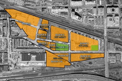
I’ve seen this project variously named King Liberty, East Liberty Village and Inglis Lands. It is “a 45-acre brownfield site located in the King Street West / Strachan Avenue area, immediately west of downtown Toronto.” The Inglis plant had been on this site off Strachan Avenue since 1881, employing at its peak 17,800 people during the second world war. The company started out building equipment for grist and flour mills, then marine steam engines and waterworks pumping engines, guns for the war effort, then consumer products after the war, including house trailers, oil burner pumps and domestic heaters and stoves, finally adding home laundry products and other home appliances for which Inglis became well known. The closure of the Strachan Inglis plant (affecting 650 employees) was announced one month after the Canada-US Free Trade agreement came into effect in 1989, and 2 years after American giant Whirlpool took a controlling stake in the company.

“The redevelopment of this site is seen as a major opportunity to create a significant new residential neighbourhood and associated employment space providing important “live-work” opportunities. Situated in the northern portion of the Garrison Common area, immediately north of Exhibition Place, these lands will play a strategic role in achieving City of Toronto policies related to residential intensification as well as embracing various smart growth initiatives. Specifically, this mixed-use development will offer this growing community new retail, office and high-tech type users.” (from IBI Group promotional material)


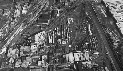
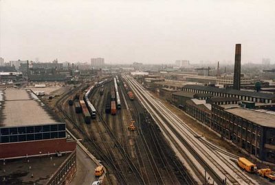
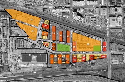
Historic buildings that will remain are in Block 12 (the central park) and Block 8. Both have connections to the old Central Prison for Men which was on this site from 1873 to 1915. The building in the park (Block 12) contains the Chapel of the Prison, is historically listed, and will be preserved as part of the park – though that probably means having a Starbucks put in. The building on Block 8 is the Liberty Storage Warehouse also known as the A. R. Williams Machinery Building at 130 East Liberty Street. This building contains part of the paint shop of the prison dating from circa 1879 – however, despite being historically listed, with many of the features of the warehouse itself (which was completed in 1929) appearing in the listing, only the southern 28m of the building will be “saved” with a 52m tower allowed to occupy the rest of the building’s footprint. The northern portion of the site was a small railway freight yard (which can be seen in the top left of the 1935 aerial photo above – north is to the left with the Exhibition Place buildings to the extreme right). The photo below is from Strachan looking west with the Inglis Plant on the left, the freight yard beyond and the Massey-Harris complex to the right. Pretty much everything in this photo is gone today except for the main railway lines.


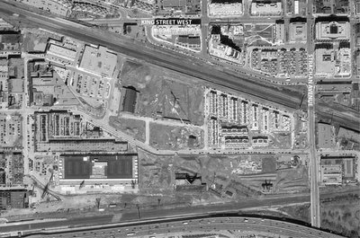
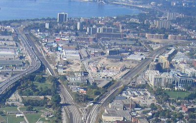
Phase 1 was the stacked townhouse development on Block 1 (that can be seen in the 2005 airphoto above) and which is now completed. These stacked towns are basically masquerading as live-work units – but whether any effort has been made to make them flexible enough to truly be live-work is questionable. I personally don’t believe this building type was appropriate; their tight ranking in rows along narrow private (sometimes pedestrian) “streets” does a poor job at promoting a good mixed-use urban image in the area and in really framing the street the way a mixed use apartment building can. To top it off, stacked townhouses in Toronto are just plain ugly most of the time – trying to look like a house but at the density of an apartment building. The marketing behind them is relatively straight-forward though – in Toronto, units with their own ground-level entrances will sell no matter where they are. Note how not a single front facade faces the small park/square on Block 1. This is not quality urban design – despite winning a Canadian Urban Institute “Brownie” award in 2005.

Phase 2 is currently under construction on Block 3 under the name “Liberty Towers” – a 24 storey building with 276 units – it’s a little unclear what else might be on that block though, so my figure of 325 units may or may not be more accurate.

Despite having a 35m height limit, Block 4 was immediately developed as a big-box Dominion supermarket with a large parking lot and a small strip mall – all one-storey. I’d classify that as embarrassing given the location, but I believe the zoning at that end precluded any residential units being built on Block 4.

We’ll see how this one pans out – there’s a chance that once the really dense buildings get in there, they’ll have found a way to save this thing. I’m worried about it though – especially from the perspective of connecivity. Directly to the north on the Massey-Harris lands there was a mixture of ugliness, misdirectedness, and beautiful moments – so lets hope some of these future phases save this area’s ass and that they do a good job on the central park and the rest of the buildings.

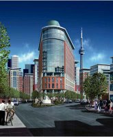
This image from IBI Group seems highly optimistic to me and possibly quite deceptive – I can only assume this is meant to be Block 7 looking east, but this building is now allowed to have a c. 4 storey (13m) podium and a c. 20 storey (61m) tower and will very doubtfully be such a “flatiron” signature building (it no longer appears to be so far forward on the block to create the wedge shape). The entire area is still very isolated, especially now that the Front Street Extension appears to be on hold yet again – and I haven’t found anything indicating concrete plans to improve this isolation. I also don’t think that there is enough real urban fabric here to make it a place that could stand on its own.

Cities & Politics – urban election results

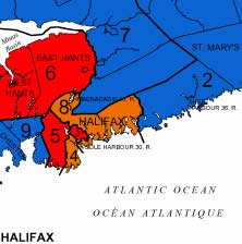
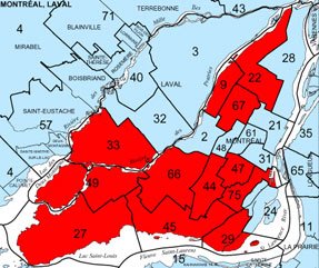
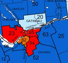
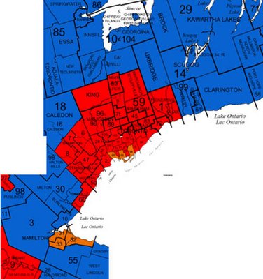
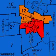
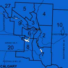
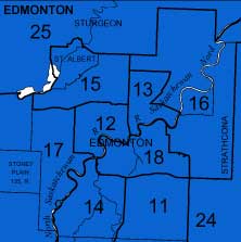
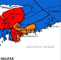
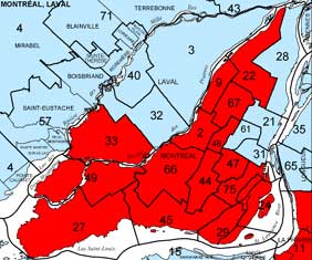
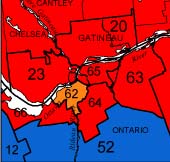
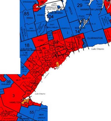
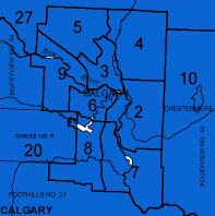
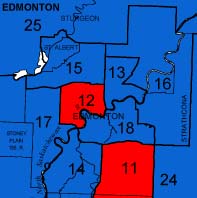
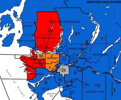
OK – sorry this took a couple of days – here are the election riding results for urban areas to compare with the pre-election situation of the last post. “Ring Around the Liberals, A Pocket full of Layton. Tories! Tories! We all fall down!” I’ll leave the analysis to the wogs. Well done Vancouver for the largest concentration of NDP seats seen in some time (5 contiguous seats!), and shame on you Alberta – the only province (well – apart from PEI which only has 4 seats) to elect candidates from only one party (boring for the map, no doubt boring in reality) – even the Quebecois have never done that! Kudos to Olivia Chow, Layton and Peggy Nash for stopping Toronto from becoming a big red rash on the country.


Cities & Politics – an election eve treat

Canadian cities outside of Alberta have a little antipathy towards voting Conservative, though suburban areas get increasingly Conservative the further out you get. This all seems like common sense – but for your viewing pleasure (and oddly showing the hard time the NDP has had winning seats even in inner cities) here are maps of the major cities across the country showing the current seat distribution as we go into tomorrow’s election. I think you can figure the colour-coding out. Props to Elections Canada for the mapping.


Railway Lands Update – Landscape Architecture Against the Ropes?

For a while it’s seemed like Landscape Architects have been increasingly relegated to subservient roles in many areas of their work outside of their core discipline of designing and overseeing construction of built landscapes. Sometimes, hard as it can be to admit, willingness to accept these roles has become a justification for this trend – references to Landscape Architects as simply putting trees and green on plans are saddening largely because of how frequently they are true. However, recent events in the Railway Lands in Toronto have highlighted the ongoing battle over Landscape Architecture’s home turf.

In some ways the momentum of design initiative itself – particularly in the urban environment – has been slipping away from Landscape Architects for some time. Whether it’s because outsiders have much fresher perspectives on the issues of landscape architecture, or overly pragmatic professional associations solidifying mediocre standards and approaches as “best practices”, or a fault in landscape architectural design education, designers without an affiliation to landscape architecture have been successfully winning many large and significant projects within the core discipline of the landscape architecture profession.

From Downsview Park‘s winning design (by Bruce Mau and Rem Koolhaas) to Dundas Square‘s controversial slickness (by Brown + Storey), landscape architects are becoming simply a required member of a team led by an architecture firm for many of the biggest landscape architectural projects in Toronto.

And now, enter some new competition. Douglas Coupland, the author and artist who “coined the term ‘Generation X’ with his book of the same name” has been “hired to design a three-hectare park” in Toronto, according to press reports released last week. The park in question is the new community park required to supplement Concord Adex’s mammoth CityPlace development in the West and Central Railway Lands. The headlines were euphoric: “Impassioned Canadian artist, Douglas Coupland, commissioned to design eight-acre urban park at Concord CityPlace”, “Coupland’s Toboggan Vision”. The Globe and Mail was more realistic – “Author Coupland to help design park”.

Never mind that the press reports are slightly inaccurate. Never mind that Coupland is in effect the artist selected for the City’s public art requirement, was selected independently of the search for a landscape architecture team, and is intended to be “working in tandem with the landscape architect.” Never mind that as far as I can tell that means that the Landscape Architect will be designing the park – and that means Greg Smallenberg of well-regarded Vancouver firm Phillips Farevaag Smallenberg, aided in Toronto by David Leinster of The Planning Partnership.

Is there something about landscape architects that makes them so much more unglamorous than other potential designers? Is there something that makes them unworthy of having the headline even when it’s one of the most significant privately-funded landscape architecture projects in the city in decades? Maybe landscape architects these days lack the vision of other designers or don’t have the same authoritative way of capturing the imagination of the public. Is it landscape architects who have lost their imagination? Let’s face it – they must be doing something wrong if everyone accepts that an artist is needed to create a great park, or that a landscape architect can’t be trusted to come up with a fresh, imaginative and interesting concept.

While on one hand I’m hurt by this attitude towards landscape architects, part of me knows and admits that the profession in Canada does desperately need some freshening up – both in imagination and authority. There are landscape architects doing great, interesting work – from built to theoretical – but we must start to accept that we can no longer take for granted our role as key designers in our core discipline. Just as landscape architects need to fight for their roles at larger scales and at the periphery of the discipline by competition and equivalence with others working in those areas, so they must join the fight in defending their own backyard so to speak – the future of design seems to be the need of designers to prove both their role and their worth regardless of professional affiliation. And the kind of self-examination and re-examination of core principles that this would require may be just what the landscape architectural profession needs.

Development in Toronto Part II – West End Update

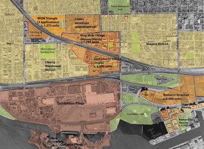
You do not want to know how long it took to get all this mapping and unit #s together. I’d call that an example of how useless the City is at presenting a comprehensive view of what’s going on. This map is from just east of Bathurst to just west of Dufferin, from the waterfront up to north of Queen. Click it to enlarge and see the number of units for many of the completed, under-construction and proposed developments in this very rapidly changing area. Some figures are estimates (with ? beside).

Development in Toronto Part I – Railway Lands


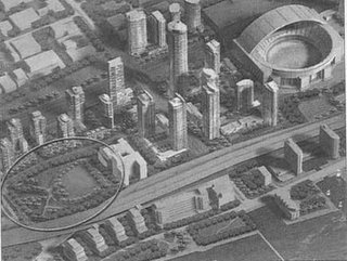
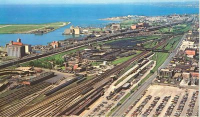
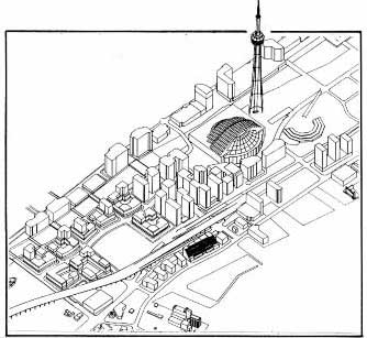
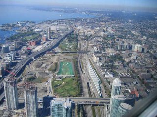
Ever get really pissed off trying to find out what the hell is going on (development-wise) in one of Toronto’s several large development projects? We’re talking showcase large scale urban brownfield sites, the likes of which – once developed – we will rarely see again, such as the Massey-Harris/Ferguson lands, the Inglis lands, and the Railway lands (shown above before the yards, and western roundhouse were removed). Now, you might think that a simple visit to the City of Toronto’s website would clarify the matter – especially for a location as fundamentally important as the railway lands. Perhaps the Planning Department would give us a clue? Nope. Do a search for Railway Lands. Aha! So here we have the Urban Design Guidelines for the Central/West Railway Lands (but just try getting there from the Urban Design page). But of course, urban design guidelines are a relatively toothless mechanism to control development (something that’s being addressed with recent proposed changes to the Planning Act, Municipal Act, Provincial Policy Statement, and Ontario Municipal Board, see Ministry of Municipal Affairs and Housing who do a great job at clearly explaining all of their work) so how do we know that what they show is what we’ll get?

Now we all know that there are comprehensive plans done for all these areas just so the developers can ever get approval. At some point no doubt there were public meetings at which the plans were shown – but where the hell are these things now? Shouldn’t people be able to see the shape of the city to come, even if they didn’t happen to be at the one or two public meetings? Wouldn’t it be helpful, informative, and simply good public policy to keep the citizens of Toronto aware and on-board – especially when the projects are large to the point of being virtually sensational? Isn’t this where the dialogue about how to make a good city, how to grow responsibly and in a way that adds to the quality of the city, should be taking place? Maybe the developers don’t want anyone to know their detailed plans? Maybe noone thinks that anyone cares once all the planning’s done? Think again.

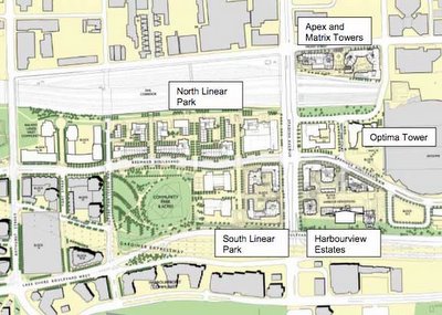
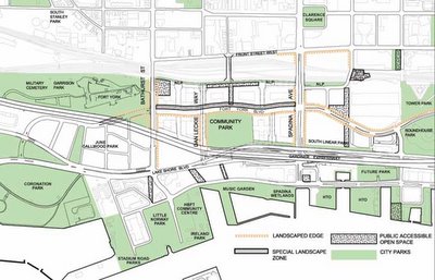
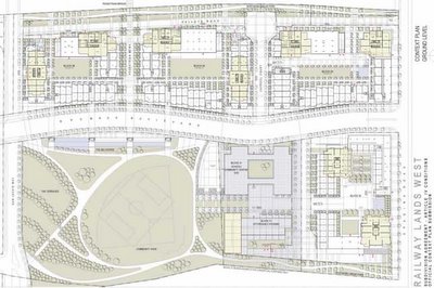
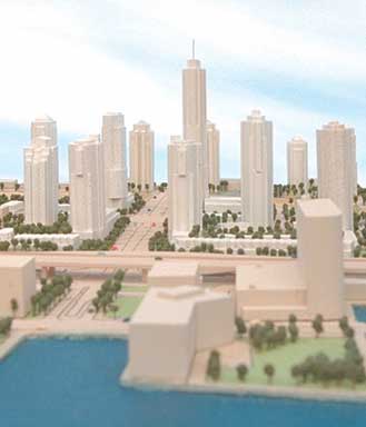
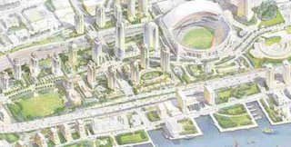
Given the disappointing results of the first phase of CityPlace (Central Railway Lands) one would think the City would be at pains to be more up front about what’s happening. On the other hand, you would think that they would be delighted to be giving out information on successful large scale development on important sites in the city. Sure the CityPlace: Railway Lands West Public Realm Master Plan, Architectural Guidelines and Implementation Plan got an honourable mention at the 2005 city urban design awards in the visions and master plans category (see here, but the real question is, did it deserve it) – but wouldn’t it be nice if uptodate information about the detailed design of this stuff as it will actually be built was continually available? It could be that I’m just slow and can’t find the information that is plainly on the City’s website. Just in case anyone else has the same trouble as me – here’s a few snapshots of what to expect in the West Railway Lands. If you don’t read plans well, or can’t picture what’s going on – tough. I challenge you to find anything better – and secretly hope you do! The two 3d images below are probably well out of date. In the detailed plan below, the block directly east (to the right) of the community park will house public schools (public and separate) and a community centre/daycare (all up against the east-west street, Fort York Boulevard). South (below) the schools buiding is an “affordable housing” complex which appears to be peculiarly isolated from all public right of ways, serviced by what looks like a private road. Why on earth we are we still building affordable housing in isolated separate buildings? Why can’t units of affordable housing be distributed individually in market-rate buildings the way it is proposed to be done in Regent Park? Anyways, somehow it all looks a little thin on the ground to me – especially for a site that on the whole particularly suffers from a physical isolation from the rest of the city, jammed as it is between the railway corridor and the Gardiner Expressway.


A Child’s Christmas in Scarborough

The following is an excerpt from a delightful little monologue written by Howard Engel for CBC Radio, now a lovely little book published by Key Porter Books and illustrated by Bill Slavin.

“Whenever I remember Christmas as a child in Scarborough, I can never remember whether the slush was new or old, or whether we lived on the sixth street north of the shopping plaza stoplights and I was seven years old, or whether it was the seventh street and I was six. But still my nose and fingertips tingle at the thought of Christmas in the row housing, whose names rang their challenging, forlorn ways down to the fast-backed, nerve-and gear-racking lanes of the freeway: Elegance Manors, Tweedingham Mews, Buckingham Back Courts.

“And I am again a boy among boys, riding our crash-barred, chrome-bedazzling bikes through the supermarket swing-doors, grabbing girls’ tuques and popsicles in the Mac’s Milk and diving with our arms spread to make angels in the snowbanks that the plows churned up, plunging our hands to the soggy, stitch-straining armpits…

“And clear as the chlorinated water in the taps, but not so clear as a secret rivulet in the snows that we boys found near the highway that was gone in the spring when the hill was cleared for a condominium, I see Uncle Harry turning away the Salvation Army girl at the door and his making us all laugh as she fell on the path, on the ice I should have chipped away.

“Christmas in Scarborough was nothing if it was not families and laughter. But before the compacts and the late-models and the single sports car owned by Aunt Hetty, the divorcee, who bought the Fugs record, before the hordes of uncles and aunts and cousins jousted for a parking spot and the superintendent appeared to ask us to remove a car that been parked in someone else’s spot, there were the presents that smothered Father’s absence due to overtime, and Mother’s voice raised in the kitchen downstairs while the supper held in the stove at low heat congealed…

“And then it was afternoon: all the cousins, friends of friends, who had been stuffed into spare rooms and cautioned to nap because they had stayed up all night in candy-caned anticipation of catching Santa and delayed for a day his return to the department store throne, were awakened and sent off into the streets…

“Then Father phoned from Number 41 Station to say that he had been in the egg nog again, and that he would be detained, and Mother drank the cooking sherry, and the turkey went unbasted.

Then Uncle Frank, who had been a stockbroker and then a convict, tried again to dance the Windfall of ’65 and fell through the picture window.

Then the neighbors knocked on our wall and we knocked on the neighbors’ wall and then the police came.”

(Howard Engel – A Child’s Christmas in Scarborough)

Beautiful – and real. Happy Christmas to all and to all a good night!

A Little Request of the TTC

OK. I’m a little behind the times. It’s been months since the TTC started installing media video screens on the subway platforms showing CP24 and advertising, but I’m only now getting around to a response.

First of all, I don’t know what the fuss is all about. The Public Space Committee and their ilk are having a fit over all this – and maybe TV is getting all-pervasive with CP24 being broadcast on a giant media screen at Yonge and Bloor and too many to count at Dundas and Yonge – but the fact is, I don’t mind having access to those scrolling news reports, and given the length of a subway platform, the size of the subway screens is easy enough to ignore if you’re not interested. And despite what the TPSC and Spacing seem interested in perpetuating, I don’t find the “design” of Toronto’s subway stations (downtown) to be wonderfully stimulating simply because they bothered to change the colour of the tiles in each station. Frankly the stations look, feel, and sometimes smell like a not-very-well-cared-for public convenience. Bring on the advertising! It’s the only thing to read on the subway when I don’t have a book or newspaper or it’s rush hour and there’s not enough room to get one out.

Some of these people seem convinced that advertising is somehow impacting the sociability of people on the subway. I don’t think these people can possibly ride the subway every day – in a WASPish society, social interaction doesn’t tend to happen on the subway unless you already know the person – that’s just not the way we are. Staring at walls and avoiding eye contact is what we do – advertising or no advertising. And while Toronto is far more diverse than being mono-WASPish, I think many of the other cultures here adopt the dominant social convention when it comes to things like subway culture. Want proof? Just ride the subway.
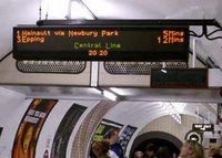
But I digress. That’s not the point. What I cannot understand is how the TTC has not required that these new video screens display the wait time for the next train the way it is done in innumerable other cities. More to the point – how can a first-class subway system like the TTC’s not afford to have their own information system for the next train? Now it might seem pointless to do so for Toronto’s simple subway system – with only 2 lines, basically all trains going to the end of the lines, and trains supposed to be never more than every 5 minutes, why would you need to know when the next train is? To me it’s simply a question of passenger appreciation – it’s always nice to know how long the wait will be because sometimes something happens and the train won’t be coming in 5 minutes. You reduce passenger anger and frustration by letting us know when the next train will be – if the first train is full and I know the second one is only 2 minutes behind it, I won’t feel so bad waiting for it.

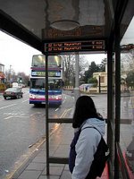
Back in July, Howard Moscoe, City councillor and chair of the Transit Commission, publicised an idea to provide electronic information screens for bus stops in suburban parts of the city. While I support this idea – (but hey let’s start with streetcar lines and frequent service routes since those are the ones without a detailed schedule – most suburban routes stick to a pretty strict, timed schedule that can be posted in print at stops) in almost every other city I can think of that has these bus information systems, they did it first on their subway system. On the Spacing Wire story, the picture they use isn’t even from a bus shelter – it’s from the Jubilee line in London (Stanmore is the northern terminus). In so many other places such as London, Paris, Rotterdam, Singapore – they believe it is worthwhile to tell passengers when the next train will be. There are far fewer subway stations than bus stops, and they already have to know exactly where every subway train is for safety purposes, so for a starter project, why is it so hard – especially when they’re replacing information screens on the subway already?
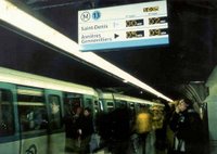
But, while I’m on this topic – let’s talk about the other side of subway communications – announcing the current station and the next station. The TTC has been beefing up its vigilance in requiring subway operators to call out the next stop and the station when they’re pulling into it. However, I was recently moved to write this article after a week of horrible rides culminating in a terrible operator announcing each station with an Eyore-like death and doom voice that for me made the act of riding the subway a tightrope walk of seasonal depression. Not to mention other times when mumbled station names were inaudible, when stations were incorrectly called, and when the mic seemed to cut out just before the station was called – “the next station is ——-“.

In many other city’s subways, such as some lines in London, all Singapore lines and on the Vancouver Skytrain, station names are called out with an automated system using a pre-recorded soothing but audible voice – almost always a woman’s – clearly announcing the stops. I don’t think this is space-age technology! Please, oh please can they start using a system like this on Toronto’s subway! I do already know all the stops – but sometimes when the car is full you can’t quite see the station name or remember what colour tiles your station happens to be (especially if you’re not on a trip you do every day). If the TTC already cares enough to require their operators to call out the stops all day long, can they please see the reason in installing an automated system?
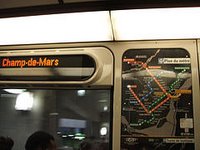
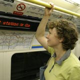
As an aside – LED displays of the current station and next station are an on-board feature of many of these same systems – giving a visual clue for those who haven’t heard or understood the audible announcement. In many other cities, they even have such displays on buses, let alone subways. A few years ago when the TTC started receiving delivery of their new subway cars, I was shocked to find that apart from being shiny steel and having red seat covers instead of orange and brown, the only real improvement over the old cars (which must have been at least 20 years old) was wider doors. There were no other technology or passenger features that made the subway-riding experience better. How many years will we have to wait now until some more sophisticated rolling stock is delivered? I prefer not to think about it. All I can say is I’m glad the TTC decided to forestall their replacement of the streetcar fleet in favour of refurbishment since I’m sure all they would have done is reorder the exact same streetcars.

No innovation here. Given the TTC’s budgetary restraints I’m not sure I blame them, but I think it’s awful that they’re not even bothering to try to leverage advertising space for improved passenger information systems. Come to think of it – Toronto sucks at that in general – take the garbage can fiasco as an example.
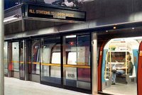
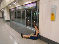
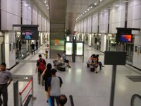
In 2002 we completed the ridiculous Sheppard Subway line at a cost of $934 million and yet the TTC did not implement any of these passenger information system initiatives – let alone some of the other passenger experience improvements of other systems such as glass walled automated platform barrier/doors that make it impossible for someone to be pushed into the tracks, stop the wind from rushing through stations, and look HOT. While I know that transit financing in Canada is so tied to politics that understanding the logic behind any of the decisions is pointless, it still bothers me that $934 million can be spent on a subway to nowhere, but nothing can be found to help improve the experience on the existing system, nor a couple of million dollars extra (on a pricetag of $934 million) to pilot a new information technology on a new line.
All I can say is, it’s sad. But in case you think it’s impossible in Toronto, go and check out York Region’s fancy new Viva rapid tranist bus system. Not only do the bus stops have displays showing how long until the next bus, but there are on-board displays showing next stop and time to next stop. Hello future.
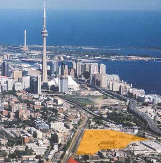
Tired of all those development notices?

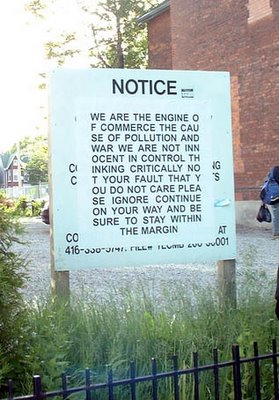
I came across this appropriation of a development notice a while ago and only just found the photo again. It was somewhere in downtown Toronto but I can’t remember where, and have no idea who committed this clever act of subversion (though suspect some of the people over at the public space committee or spacing might know something about it).
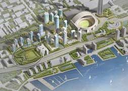
Not that I have anything against development. I guess I have something against the way it happens and the kinds of buildings that get built – and sometimes the kinds of buildings that get torn down to make it happen – but most of the time I’m just hoping the current building boom will last long enough for Toronto to get rid of a few more of the surface parking lots that still dot the downtown – one of the most offensive reminders of the ridiculous nature of development economics (since all of them would have had buildings on them, now long demolished because surface parking is so damn profitable).